- Summary
- Table Of Content
- Methodology
GIS Controller Market Size:
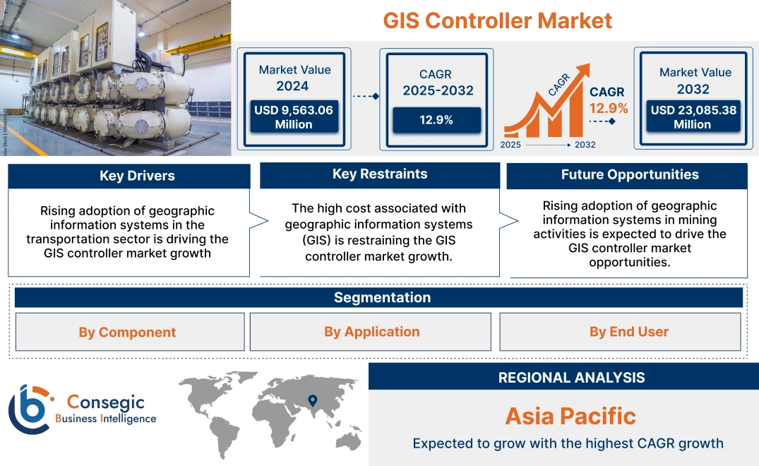
GIS Controller Market size is estimated to reach over USD 23,085.38 Million by 2032 from a value of USD 9,563.06 Million in 2024 and is projected to grow by USD 10,510.38 Million in 2025, growing at a CAGR of 12.9% from 2025 to 2032.
GIS Controller Market Scope & Overview:
GIS (Geographic Information System) controller refers to a technology that consists of hardware and software for capturing, analyzing, visualizing, and analyzing spatial and geographical data. Further, geographic information system enhances resource management, urban space planning, real-time monitoring, and mapping of geographic information. Additionally, the geographic information system controller is used in various industries including mining for mineral extraction, transportation for managing traffic, construction sites for infrastructure development, and others.
Key Drivers:
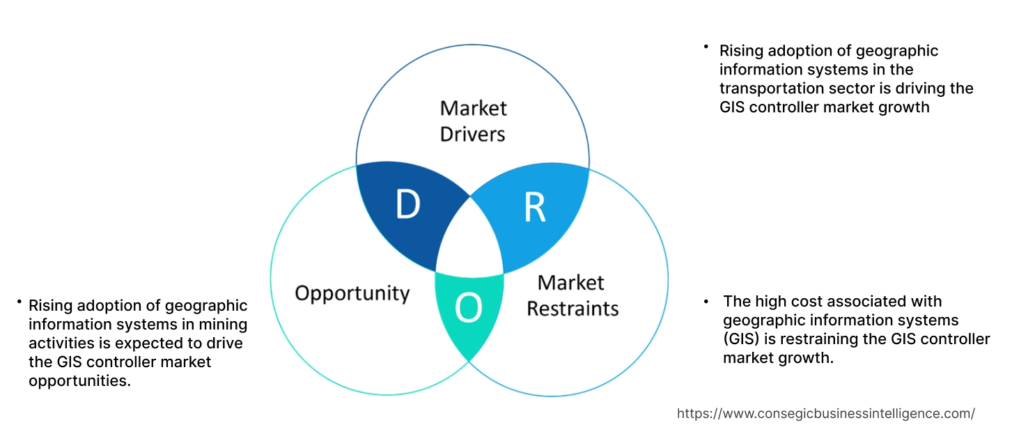
Rising adoption of geographic information systems in the transportation sector is driving the GIS controller market growth
In transportation, geographic information systems are used for managing, monitoring, and visualizing complex transportation planning. Moreover, it enhances route optimization, improves traffic management, and ensures safety and security in transportation by analyzing data in real time. Additionally, in the transportation industry, it enables advanced management of operations and fleets in railways & ports, transit, airports, roads & highways, and others through visualizing locations for operational efficiency.
- For instance, according to the OICA (International Organization of Motor Vehicle Manufacturers), in Europe 17,898,967 vehicles were sold, which is an 18.7% increase as compared to 2022. This is further driving the market demand for geographic information systems for analyzing and managing traffic on roads and highways.
Thus, the rising adoption of GIS controllers in transportation sector is driving the GIS controller market size.
Key Restraints:
The high cost associated with geographic information systems (GIS) is restraining the GIS controller market growth.
The implementation of geographic information systems is usually associated with high costs, which is a prime factor restricting the growth of the market.
- For instance, the average cost of geographic information systems ranges from USD 1,500 to USD 800,000 per system, owing to the additional costs of including the digitizer, readers, data drives, GPS units, and wiring network configuration.
- Additionally, the price of software ranges from USD 1,000 to USD 17,000 per system, owing to the need for continuous updates and maintenance for better functionality of the software, which is relatively very high in comparison to the cost of conventional information systems for analyzing spatial data.
Therefore, the high cost associated with the implementation of geographic information systems is restraining the market.
Future Opportunities :
Rising adoption of geographic information systems in mining activities is expected to drive the GIS controller market opportunities.
In the mining sector, a geographic information system controller is implemented for efficient mining operations through captured, stored, and analyzed data. Further, a geographic information system is implemented in the management structure for mining operations such as extraction and exploration of minerals. Moreover, it is used in various applications such as ensuring the safety of people working in mines, streamlining operations, and reducing environmental impact through mapping and surveying of mining locations. Additionally, it is implemented in mines for accurate site planning, monitoring, and finding transportation routes for miners.
- For instance, CyberSWIFT offers geographic information system-based mining solutions in its product offerings. It offers various benefits such as the erection of boundary pillars, mapping by remote sensing, and WEBGIS application for mining.
Thus, as per the GIS controller market analysis, the rising utilization of GIS controllers in the mining sector is driving the global GIS controller market opportunities.
GIS Controller Market Segmental Analysis :
By Component:
Based on components, the market is segmented into hardware and software.
Trends in the Component:
- There is an increasing trend towards the adoption of geographical information system software in field surveys for data collection.
- Rising utilization of hardware components is trending for monitoring, processing, storing, and connecting to the network.
Hardware accounted for the largest revenue in the total GIS controller market share in 2024
- Hardware in geographical information systems consists of memory (workstations or CPU), computers, plotters, data storage devices, digitizers, printers, scanners, global positioning system (GPS) units, tape drives, and others.
- Further, drives are used for collecting data, while a plotter is used for processing data, and a digitizer is used for converting analog data into digital format.
- Moreover, hardware is used for various applications including running geographical information system software and storing geographical information system datasets.
- For instance, in February 2024, Huawei launched data storage solutions for high data mobility requirements.
- Thus, the rising advancements associated with hardware components such as storage devices are driving the GIS controller market size.
Software is anticipated to register the fastest CAGR during the forecast period.
- In geographical information systems, software consists of graphical user interface apps, database management systems, and geographical information system programs.
- Moreover, the software processes information using algorithms for data visualization and analysis to present it in the form of maps and graphs.
- Additionally, geographical information system software is used for retrieving, managing, storing, and analyzing all sorts of spatial and geographical data.
- For instance, in May 2024, CHC Navigation launched MapCloud, a mapping application and a geographical information system data capture for Android devices for collecting data from surveys.
- Thus, the rising advancements in geographical information system software are driving the GIS controller market trends.
By Application:
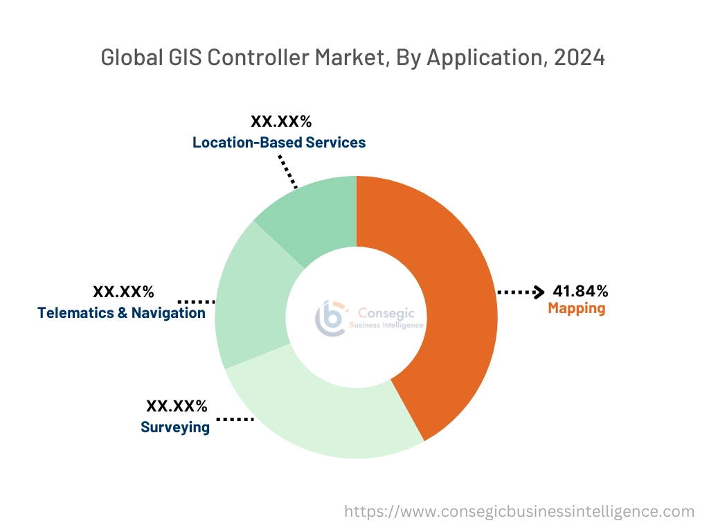
Based on the application, the market is segmented into mapping, surveying, telematics & navigation, and location-based services.
Trends in the Application:
- There is an increasing trend towards the adoption of geographical information systems in location-based services such as GPS and others.
- Increasing utilization of GIS controllers in the transportation sector for navigating and viewing the map from different angles.
Mapping accounted for the largest revenue share of 41.84% of the total GIS controller market share in 2024.
- Geographical information system comprises hardware and software technology that is used for mapping all sorts of data.
- Moreover, a geographical information system enables individuals to connect collected and stored location data to a map, for analyzing information about a location.
- For instance, in January 2024, Kozhikode Corporation launched geographical information system mapping for scanning drainage, roads, waste management systems, bridges, street lights, and other public assets.
- Thus, the rising adoption of geographical information systems for mapping applications is driving the GIS controller market.
Surveying is anticipated to register the fastest CAGR during the forecast period.
- Surveying consists of collecting and analyzing spatial data through hardware sensors and software on the map.
- Geographical information system enhances decision-making by providing accurate spatial data for geographical planning.
- Additionally, it is used in urban planning, disaster management, infrastructure development, transportation management, waste management, and others.
- For instance, in July 2024, GHMC (Greater Hyderabad Municipal Corporation) launched an integrated GIS survey for the development and planning of Greater Hyderabad Municipal Corporation to visualize, manage, and analyze spatial data.
- According to the analysis, the rising utilization of GIS controllers for surveying applications is driving the GIS controller market expansion.
By End-User:
Based on the end-user, the market is segmented into oil & gas, construction, mining, transportation, and others.
Trends in the End-User:
- There is an increasing trend toward the adoption of geographical information systems in the oil & gas sector for the maintenance and storage of pipelines.
- Increasing utilization of geographical information software in mining for evaluating mining conditions, target mineral exploration, and others.
The transportation segment accounted for the largest revenue share in the total GIS controller market in 2024.
- Geographical information system is used in the transportation sector including ports, roads and highways, airports, railways, and others.
- Moreover, geographical information system enables visualization and analysis of spatial data for management and planning of transportation.
- For instance, ESRI offers a geographical information system for transportation in its product offerings. It offers various benefits such as customer service, security, improved operations, response, and enhanced decision-making to support smart transportation systems.
- According to the analysis, the rising adoption of geographical information systems in smart transportation systems for improving traffic management is driving the GIS controller market trends.
Construction is anticipated to register the fastest CAGR during the forecast period.
- In the construction sector, engineers and construction delivery teams use geographic information system mapping software for analyzing, visualizing, and managing geographical information.
- Additionally, it is used in assessing environmental impacts, planning urban spaces, designing sustainable buildings, and others.
- Further, in the construction site, geographic information systems are implemented for monitoring the progress of a construction project and its activities.
- For instance, Procore offers geographic information systems for construction applications in its product offerings. It offers various benefits such as inspections, real-time tracking of projects, and others.
- According to the analysis, the rising utilization of geographical information systems in construction sites for planning and surveying applications is driving the market.
Regional Analysis:
The regions covered are North America, Europe, Asia Pacific, the Middle East and Africa, and Latin America.
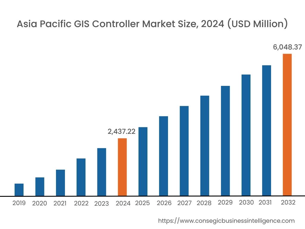
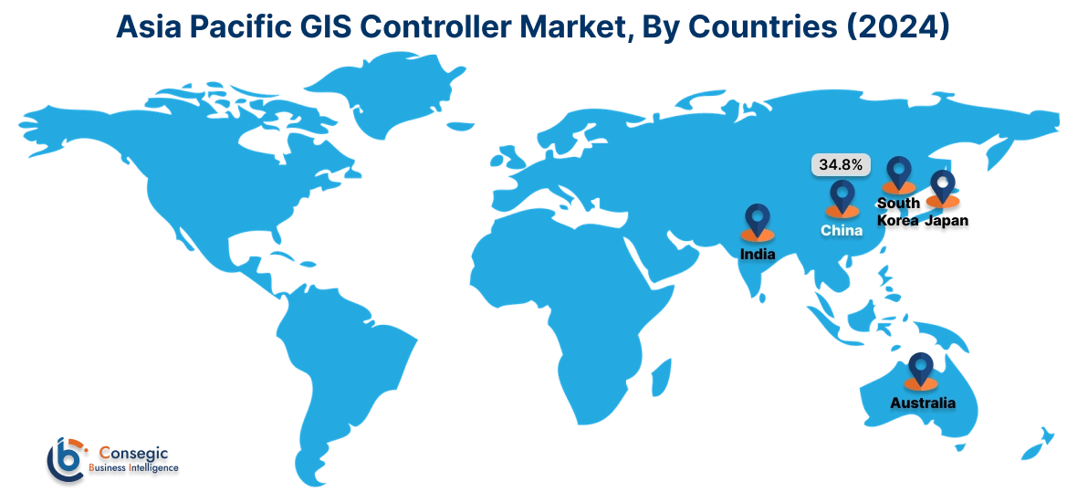
Asia Pacific region was valued at USD 2,437.22 Million in 2024. Moreover, it is projected to grow by USD 2,684.91 Million in 2025 and reach over USD 6,048.37 Million by 2032. Out of this, China accounted for the maximum revenue share of 34.8%. As per the GIS controller market analysis, there is an increasing adoption of geographic information systems, particularly in countries such as China, India, and Japan, for providing advanced features in construction, transportation, mining, and others. The rapid development and growing investments in the infrastructure and transportation sector are accelerating the GIS controller market expansion.
- For instance, according to India Investment Grid, in the Union Budget 2023 government announced UIDF (Urban Infrastructure Development Fund) of USD 1.2 Billion. This is further driving the adoption of geographic information systems for mapping and surveying applications in construction sites, thereby, propelling the market growth in the Asia-Pacific region.
North America is estimated to reach over USD 8,010.63 Million by 2032 from a value of USD 3,349.72 Million in 2024 and is projected to grow by USD 3,678.67 Million in 2025.
In North America, the growth of the GIS controller industry is driven by the rising demand for advanced solutions in modern construction, mining, transportation systems, and others. The rising adoption of advanced information systems for advanced traffic monitoring solutions is also driving market growth. Further, increasing advancements in construction operations and a rising number of vehicles are massively contributing to growth in GIS controller market demand.
- For instance, according to the OICA (International Organization of Motor Vehicle Manufacturers), in North America 23,247,296 vehicles were sold, which is an 11.4% rise as compared to 2022. This is further driving the adoption of geographic information systems in advanced transportation systems for analyzing and managing traffic, which in turn is driving the market in North America.
The regional analysis depicts that the rising investments in transportation sector and the increasing adoption of spatial analytics is driving the GIS controller market demand in Europe. Further, as per the market analysis, the primary factor driving the market growth in the Middle East and African region includes increasing investment in advanced construction projects in the public and private sectors. The rising demand for modern geographic information systems in mining processes is driving the market demand in the Latin America region.
Top Key Players and Market Share Insights:
The GIS controller market is highly competitive with major players providing services to the national and international markets. Key players are adopting several strategies in research and development (R&D), product innovation, and end-user launches to hold a strong position in the global GIS controller market. Key players in the GIS controller industry include -
- Bentley Systems Incorporated (US)
- ESRI (US)
- Blue Marble Geographics (US)
- Trimble Inc. (US)
- SuperMap Software Co., Ltd. (China)
- Hexagon AB (Sweden)
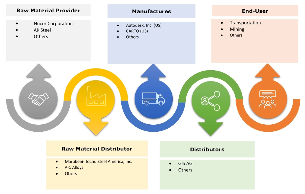
- Autodesk, Inc. (US)
- CARTO (US)
- General Electric Co. (US)
- Caliper Corporation (US)
Recent Industry Developments:
Product Launches:
- In January 2024, ComNav Technology LTD. launched P6H, an advanced geographic information system for collecting data in outdoor operations with improved portability and enhanced precision.
- In August 2021, the Union Minister of Rural Development launched the Yuktdhara GIS-based planning portal in India for rural infrastructure development.
GIS Controller Market Report Insights :
| Report Attributes | Report Details |
| Study Timeline | 2019-2032 |
| Market Size in 2032 | USD 23,085.38 Million |
| CAGR (2025-2032) | 12.9% |
| By Component |
|
| By Application |
|
| By End-Use |
|
| By Region |
|
| Key Players |
|
| North America | U.S. Canada Mexico |
| Europe | U.K. Germany France Spain Italy Russia Benelux Rest of Europe |
| APAC | China South Korea Japan India Australia ASEAN Rest of Asia-Pacific |
| Middle East and Africa | GCC Turkey South Africa Rest of MEA |
| LATAM | Brazil Argentina Chile Rest of LATAM |
| Report Coverage |
|
Key Questions Answered in the Report
How big is the GIS controller market? +
The GIS controller market was valued at USD 9,563.06 Million in 2024 and is projected to grow to USD 23,085.38 Million by 2032.
Which is the fastest-growing region in the GIS controller market? +
Asia-Pacific is the region experiencing the most rapid growth in the GIS controller market.
What specific segmentation details are covered in the GIS controller report? +
The GIS controller report includes specific segmentation details for component, application, end-user, and region.
Who are the major players in the GIS controller market? +
The key participants in the GIS controller market are Bentley Systems, Incorporated (US), ESRI (US), Hexagon AB (Sweden), Autodesk, Inc. (US), CARTO (US), General Electric Co. (US), Caliper Corporation (US), Blue Marble Geographics (US), Trimble Inc. (US), and SuperMap Software Co., Ltd. (China).
